Panel 9 : A ring of stone
When it was completed, the walled enclosure of the fortified town had 9 gates. Five of these opened out onto the banks of the Isle and another, the Bédignon, onto the banks of the Dordogne. The three remaining gates faced the surrounding countryside. This arrangement reflected the importance of port trade for the town. The layout of the enclosure followed the quays and tree-lined avenues which surround the town centre.
These fortifications, which remained in place until the 18th century, were comprised of more than merely a wall and a few towers. Outside the town, there were two successive ditches in front of the wall. Fortresses, called barbicans, protected access to the main gates facing the countryside. These sites were transformed into promenades in the 18th century at the request of the Marquis de Tourny, the King's steward in Guyenne.
Inside the town, a circular street ran along the entire length of the wall. This was Rue des Murs. The term 'mur' in Occitan does not refer to a stone wall, but to a fortification. This street could be used to check the state of the enclosure in the event of a bombardment, to transport troops to an area under attack, or to organise internal defence if an open breach gave the enemy a way in. The surrounding wall, more than one metre thick and 10 to 12 metres high, was topped by a crenellated sentry walk and machicolations for attacking the enemy. Loopholes in the wall for archers completed the defence.
Geography was also an important factor in protecting the town. There was plenty to hinder an army corps wishing to attack the town, with the rivers Isle and Dordogne by the port, the Lour stream and Priourat marshes inland, the Riouvert marshes not far from the bridge over the Dordogne, and the Fourrat marshes and barracks near the Fronsac bridge.
The Grand Port Tower, a surviving trace of this enclosure
Although it is now largely destroyed, fragments of the fortified enclosure have survived between the houses, some of which can still be seen from the street. This is particularly true for Rue des Murs, Rue Lamothe and Rue des Docteurs Moyzès. The Grand Port Tower is the most significant of these remains.
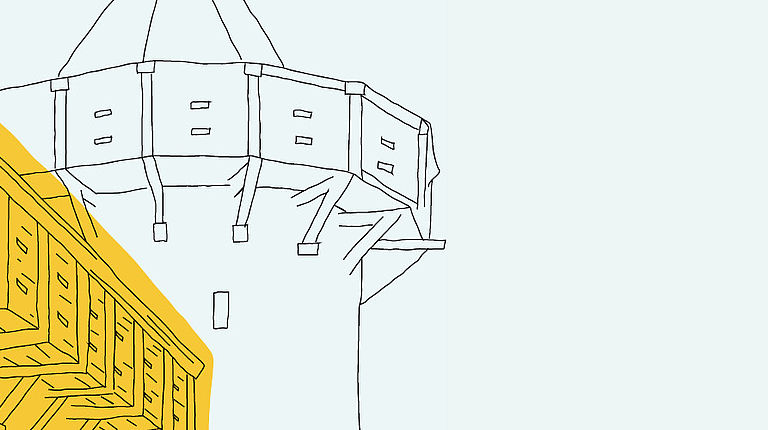
A / An imposing defensive structure
It is actually a gateway protected by an imposing defensive system consisting of two towers of unequal height. The highest is known as the ‘Tour Richard’ and the smaller one as the ‘Tour Barré’.
This ensemble of buildings contains many of the elements of 15th century military architecture, including loopholes in the towers to allow crossfire, crenellations and machicolations at the top of the walls, and murder-holes directly above the door for dropping all sorts of projectiles onto the enemy. Last but not least, there are slides for the portcullis - the vertical grate which protected the wooden panels of the door when lowered.
The Grand Port Tower was therefore one of the most important fortifications in the walls surrounding Libourne. Its only equivalent was the Porte de Saint-Émilion, located on the site of the current Place du Doyen Carbonnier.
B/ An important centre of activity
Due to its location, the Grand Port Tower oversaw the main activities of the port. These were mainly concentrated on the Quai de l’Isle. The gate provided access to the Rue des Chais (where many merchants' warehouses were located), the Grand Rue (a shopping street leading to the market square) and to the Saint-Émilion gate further out, which opened onto the countryside inland.
It was mainly commercial activities which kept the Tower and its surroundings a centre of activity on a daily basis Once through the gate, there were shops nearby, an example of which survives in a 16th century house on the rear forecourt, just opposite the entrance, and the Craberie market (which no longer exists), which was mainly devoted to butchers and fishmongers.
Sailors, travellers, traders and dockers frequented the area, even at night. This gate was the only one to be equipped with a wicket. This allowed you to enter Libourne after dark without having to present yourself at the guardhouse.
This gate, which was justifiably regarded as the main access to the fortified town from the port, was called the ‘Grand Portail de la Mer’ (Great Gateway to the Sea) until the 16th century. For a long time, it was thought that river areas in which the tides played a role belonged to the sea.
C/ Through the centuries
It was not until the 16th century that the Tour Richard was topped with the conical slate roof which gives it its distinctive silhouette. At the same time, a town clock was installed on one of its high windows. This clock remained in place until the 1930s and gave the Tour Richard the name ‘Tour de l’Horloge’ (the clock tower). The mechanism was placed in a wooden box on the floor of the third level, with a gap in the lower levels for the weights to pass through.
It was from the 17th century onwards that the Tower's purpose changed considerably.
In 1653, during the latter stages of the Fronde, Libourne underwent its final military siege. It became clear that, three centuries after their construction, the walls of the fortified town could only provide very limited defence against the advances made in artillery. However, the arrival of Louis XIV and the Treaty of the Pyrenees in 1659 permanently removed any areas of conflict from the South West. From then on, interest in Libourne's fortifications began to wane.
It was against this context that the municipality obtained permission to proceed with the first demolitions. Consequently, the Grand Rue (now Rue Victor Hugo) was extended to the Port de l'Isle. This work, which was intended to improve access to the market place, resulted in the wall being breached and the Grand Port Tower losing its role as a gateway to the town.
Gradually, the people of Libourne were able to construct buildings against the surrounding wall or use certain elements of it for civilian purposes. In 1671, the municipality granted the right to occupy the Tower to a family of carpenters who set up their workshop there. Extensions were allowed over time. This happened to such an extent that the gate itself disappeared, hidden by houses that soon encircled the base of the building.
This situation, however, saved the tower from demolition during the Revolution. In 1794, the Libourne authorities decided to demolish most of the remaining towers and gates belonging to the fortified enclosure. The authorities considered them to be symbols of the old feudal power which were now destined to disappear. When confronted with the demolishers’ pickaxes, the occupants of the Tower and the houses adjoining it made claims and demands for compensation. These were grounds enough for the project to be abandoned.
It was only between 1920 and 1980 that the Grand Port Tower regained its medieval splendour following classification as a Historic Monument. It is thanks to the gradual purchase and demolition of the various properties which surrounded it, and to the successive restoration campaigns which followed, that the most important remains of Libourne's walls can now be seen clearly today.